 At door two I was writing about weather from a holistic perspective, today I will talk more specific about the mountain weather. I’ve been talking with Klas Kempe and Hakan Hultberg both meteorologist with deep competence in this area. When it comes to mountain weather, the prognosis maintained a high quality. The first advice will be to listen/read to the latest report. And one very important fact, never ever ignore a warning. Prognosis is a fresh product, so be sure you always got the absolute latest version. Today we normally got the technical condition for being able to do that.
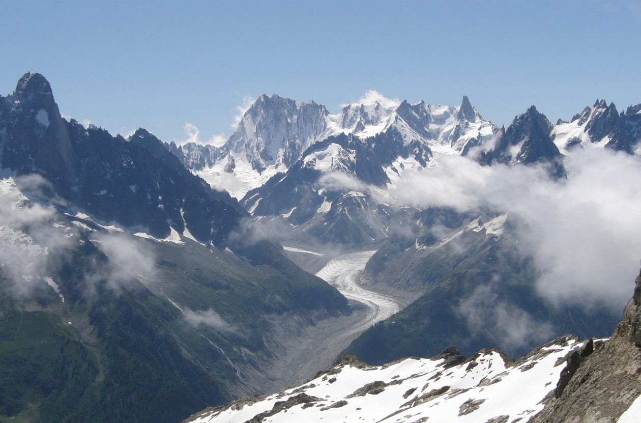
One important thing to understand about the mountain prognosis is that prognosis Modell must be slightly smoothed for computational reasons (model resolution). You can not include all tops e.g. and Sarek. The Sarek massif will be a leveled mountain massif with an altitude of 1200-1400 meters and slightly above. This also applies to Kebnekaise. Local effects can therefore be worse than what is said in forecast. This is also important to understand.
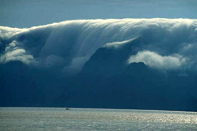 Katabatic winds is another phenomena you have to have in mind in the mountain areas. Katabatic wind is sometimes also called falling wind, but the latter can also be downward wind from Cumulonimbus clouds (village clouds / thunder clouds). A variant of catabatic wind is when cold air that has stagnated on a high plateau is suddenly set in motion. Stagnant air in winter in high pressure can, over snow surfaces, become very cold. In valleys severe cold but on bare scales and peaks never as cold. If the high pressure weakens and breaks down, the wind can increase and set the cold air in motion. This really heavy air (high density) accelerates due to the gravitational force, down slopes and ravines. The wind can then reach storm strength (25 m / s), extremely even hurricane (33m / s), at least in the wind gusts. If the air has a temperature of -15 degrees, the perceived temperature in a storm or hurricane will be below -30 degrees with a high risk of freezing or if you are unprotected for a long time also cooling, which is very dangerous (Anaris). Often the increase in wind comes quickly. There is a warning sign. If you travel in calm and nice mountain weather but see a snow drift from the peaks (the peaks are smoking) or you hear how the wind higher up ”thunders”. Then you should be prepared to seek protection. In addition to Anaris, strong katabatic winds can hit the Riksgränsen and Torne Träsk area when cold stagnant air from Kebnekaise is set in motion by strong south winds. This of course also applies to other areas with similar conditions. We often have a much more modest variant of katabatic wind at night when cooled air flows down slopes. Then it’s about someone or a few m / s.
Lay wind.
Waves form in the air when passing a mountain range and under certain conditions. The flow should be perpendicular to the mountain range with a deviation of about 30 degrees. Westerly winds (270 degrees) are common in the mountains, favorable then 240 degrees to 300 degrees. Another condition is that the wind increases with height, which is most common. A third condition is that the air at the passage of the top or ridge is stably temperature-layered (explained in book and course), which means that the air is forced over the mountain (against its will) and returns as quickly as possible to its original position (equilibrium position). This stability gets the air gets the air by flowing over cold snow. Especially if the reading side is steep, the air rushes down to the equilibrium position and can accelerate sharply. There is thus no shelter on the reading side, it blows much more than on the windward side. There may be a storm or hurricane, at least in the wind gusts. A typical example is the steep reading side of Helagsfjället (winter) at these wind directions. A reading side that is not steep, slopes slowly, never gets as strong a gust of wind. The increase in wind can come quickly and very unexpectedly. 10/1 2019, the wind was westerly over Helagsfjället. At 07.00 in the morning, an average wind of 3 m / s was measured with 7 m / s in the wind gusts. 10 minutes later the average wind was 4 m / s with 19 m / s in the wind gusts and 10 minutes later 13 m / s and 28 m / s (storm gusts). The highest village wind speed at Helags so far is 52 m / s (hurricane villages are 33 m / s). Here it is enough to travel a bit north towards Sylarna or south towards Ramundberget to avoid the worst winds. Another example of strong winds is Stekenjokk. Here it blows most winter time in the sector north via west to southwest. The air then flows over the snow surfaces on BØrgefjellet. At the Swedish border (the stable temperature-layered air) the air falls between 300 and 400 meters and accelerates. The highest average wind speed is 48 m / s, in the wind gusts it was then over 60 m / s. The wind at Stekenjokk can be considered extreme, but it also affects the mountains nearby, such as Borgafjällen and Marsfjället, as well as the towns of Kittelfjäll and Klimpfjäll.
Venture effects.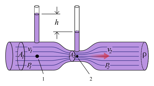
When the air blows through a valley that is somewhat in the wind direction, the wind speed is increased. It is the same phenomenon as when water in a hose is forced to pass a constriction. Then the speed of the water increases. The increase in wind can come quickly. A good example is Stora Sjöfallet when the wind turns to the northwest (which is in the direction of the valley). The wind speed can then be moderate up at Ritsem where the valley is wide. The valley narrows considerably at Suorva and Stora Sjöfallet, which means a marked increase in wind. In strong northwesterly winds (behind a low pressure) the wind can reach storm strength, hurricane 38 m / s in average wind has been measured. The strong northwest wind then continues down towards Saltoluokta. In the entire mountain range there are valleys that are narrow and where the wind can blow more than in the forecasts. In Sarek and Kebnekaise, such valleys are very common. Further south, e.g. Syterskalet and in Jämtland / Härjedalen all valleys at Lunndörrsfjällen. If you know the wind direction and approximately how much is expected to blow in the forecast, you can assume that they will be worse in narrow valleys. Sometimes a combination of catabatic winds and the venturi effect can produce strong winds. A typical example is Sylarna by wind around the south. The air is then forced up over the slopes north of the Squirrel Pass. After passing the pass height, the air flows down towards Sylarnas mountain station, accelerates and is also affected by the surrounding high mountains (venturi effect). With a northerly wind, there will be no significant increase in wind at Sylarnas weather station. The strongest winds occur during the winter months when the low pressure activity is greatest. The air is then heavy and cold. In summer, strong winds can occur on the bare mountain, but usually for a short time, generally less than a day.
See ya tomorrow…
Interesting but complex topic Bergman.
This is seriuos stuff when you heading up the mountains.
Always be prepaired and never be afraid to sray put. Dont do as the guide who got dismissed. Never go out in a storm.